Elena Walter · 16 September 2026
Thermal Mapping Techniques Reveal Hidden Stress Points in Coastal Infrastructure Projects
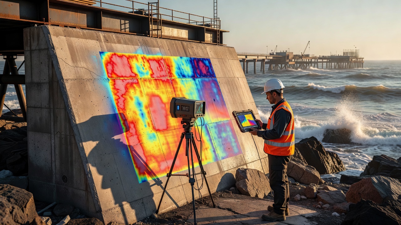
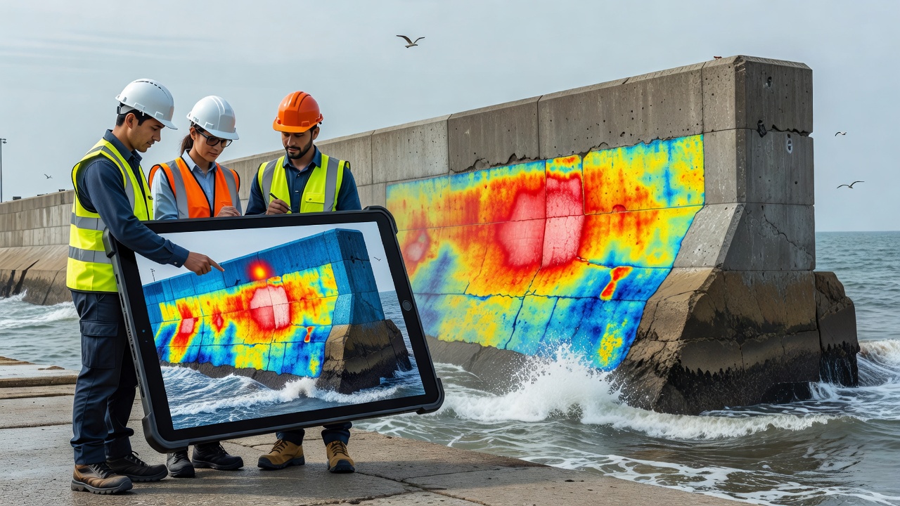
Thermal mapping applies infrared sensors and drone-mounted cameras to detect temperature differences across surfaces of piers, seawalls, and breakwaters, where variations often signal subsurface cracks, corrosion, or moisture intrusion that visual inspections miss. Engineers deploy these systems along coastlines from California to the North Sea, capturing data during low tide windows to map heat signatures that indicate structural fatigue caused by wave action and salt exposure. Data collected in this manner integrates with geographic information systems, allowing teams to overlay thermal readings onto three-dimensional models of infrastructure elements for precise location of anomalies. Researchers at institutions across North America and Europe have refined sensor calibration protocols since the early 2020s, achieving spatial resolutions down to five centimeters on vertical surfaces. These improvements enable detection of delamination in concrete and steel fatigue before visible spalling occurs. Coastal projects in regions with high tidal ranges benefit particularly, since thermal contrasts become pronounced when water recedes and exposed materials adjust to air temperatures at different rates depending on internal integrity.Core Principles of Thermal Data Acquisition
Passive thermal mapping relies on natural solar heating cycles, whereas active methods introduce controlled heat sources to highlight conductivity differences within materials. Both approaches record emitted infrared radiation, which processing software converts into color-coded maps that highlight cooler or warmer zones corresponding to voids, water infiltration, or metal loss. Field teams conduct surveys at dawn or dusk to minimize atmospheric interference, and they repeat flights at consistent intervals to track progressive changes over months or years.
Equipment choices vary by project scale, with handheld units suited for smaller jetties and fixed-wing drones covering kilometers of shoreline in single passes. Calibration against known emissivity values of concrete, steel, and composite coatings ensures accurate readings, while ground-truthing with core samples validates thermal indications at selected locations. According to reports from the European Environment Agency, such combined datasets have supported maintenance prioritization along Mediterranean ports where erosion rates have accelerated.
Applications Across Coastal Regions
Port authorities in Australia have applied thermal surveys to wharf decks in Sydney and Melbourne harbors, identifying hidden voids beneath asphalt overlays that traditional hammer tests overlooked. Similar programs along the Gulf of Mexico have mapped stress concentrations at pile caps where storm surges have accelerated corrosion. In each case, thermal data feeds directly into asset management databases that schedule repairs before full structural failure develops.
September 2026 marks the scheduled release of updated coastal resilience guidelines by the National Oceanic and Atmospheric Administration, which incorporate thermal mapping thresholds for federal funding eligibility on infrastructure retrofits. These guidelines reference multi-year datasets showing that early detection reduces repair costs by directing interventions to specific high-risk segments rather than uniform replacement campaigns.
Integration with Complementary Monitoring Methods
Thermal mapping rarely stands alone, instead combining with acoustic emission sensors, strain gauges, and LiDAR scans to build comprehensive condition profiles. When temperature anomalies align with acoustic hits or displacement measurements, engineers gain higher confidence in locating hidden defects. Software platforms now fuse these streams in real time, generating risk heatmaps that update as new flights occur.
One study from the University of British Columbia documented how thermal-acoustic pairings detected fatigue cracks in steel sheet piles along Vancouver Island ferry terminals six months earlier than scheduled visual inspections alone would have allowed. The approach proved especially useful in high-traffic zones where access windows remain limited.
Technical Challenges and Mitigation Strategies
Environmental factors such as wind, humidity, and solar loading introduce noise into thermal datasets, requiring post-processing filters and multiple flight passes under varying conditions. Salt spray can obscure lens surfaces, prompting operators to install protective enclosures and schedule frequent cleaning. Data storage demands grow rapidly with high-resolution surveys, leading agencies to adopt cloud-based repositories that support collaborative analysis across contractor teams.
Standardization efforts by the International Organization for Standardization continue to define minimum reporting formats, ensuring comparability between projects conducted in different climatic zones. These standards address emissivity measurement procedures and minimum overlap percentages for image mosaics, reducing interpretation discrepancies that previously delayed decisions.
Future Developments Expected by 2026
Advances in multispectral sensors and machine-learning classification promise automated flagging of stress indicators, shortening the interval between survey and maintenance recommendation. Projects scheduled for late 2026 along the Baltic coast will test satellite-augmented thermal monitoring that supplements drone coverage during storm seasons when low-altitude flights become unsafe.
Conclusion
Thermal mapping supplies objective data that complements existing inspection regimes for coastal infrastructure, revealing subsurface conditions that influence long-term durability. Continued refinement of acquisition methods and integration protocols supports more targeted interventions across varied geographic settings. As datasets accumulate through 2026 and beyond, agencies gain clearer pictures of how environmental loads translate into structural responses, informing resource allocation without reliance on subjective assessments.